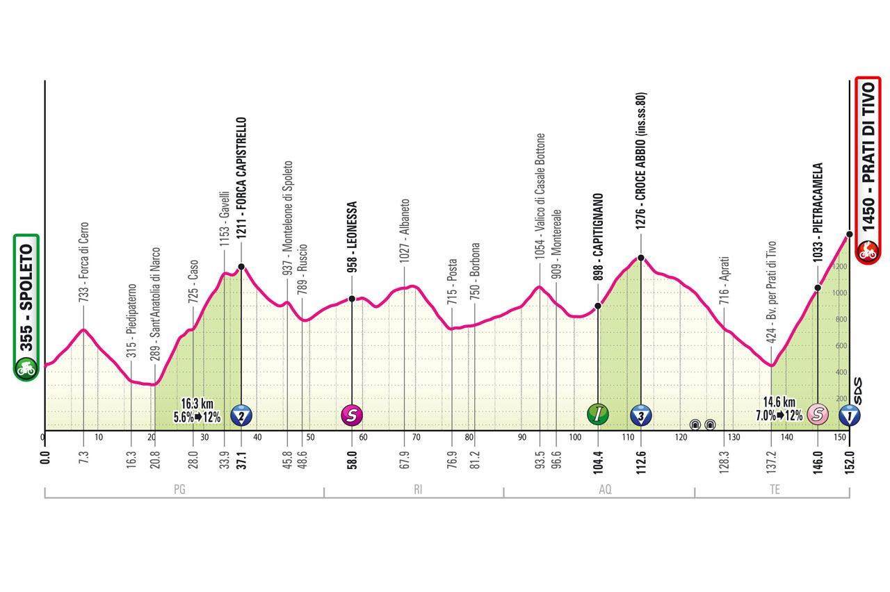
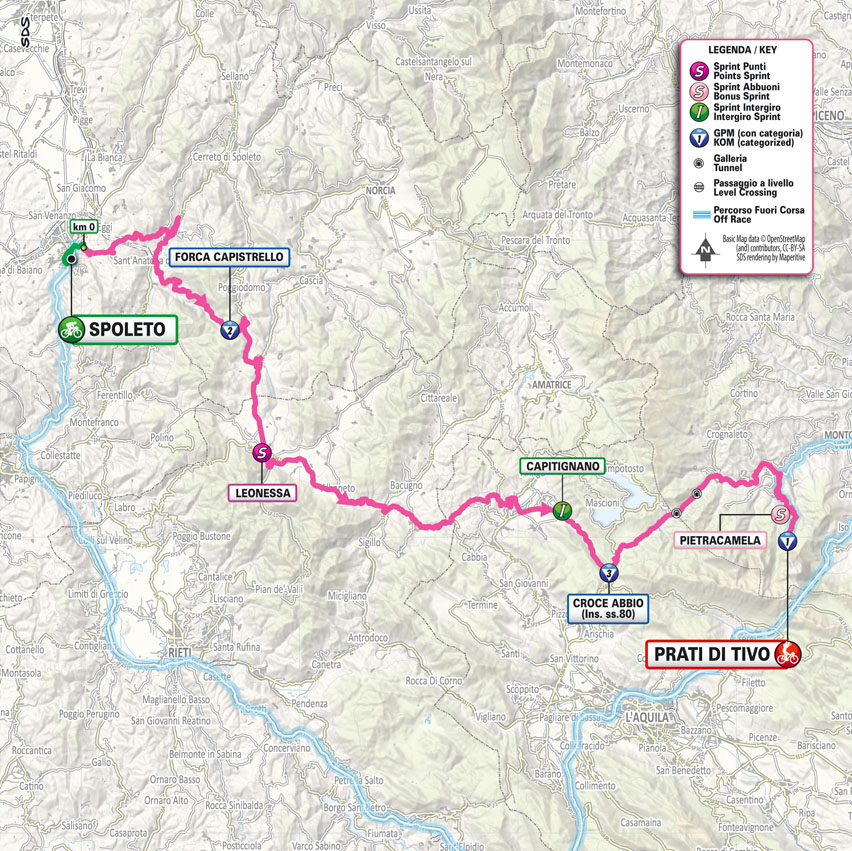
152 km - Altitude Gain 3850m
Stage 08
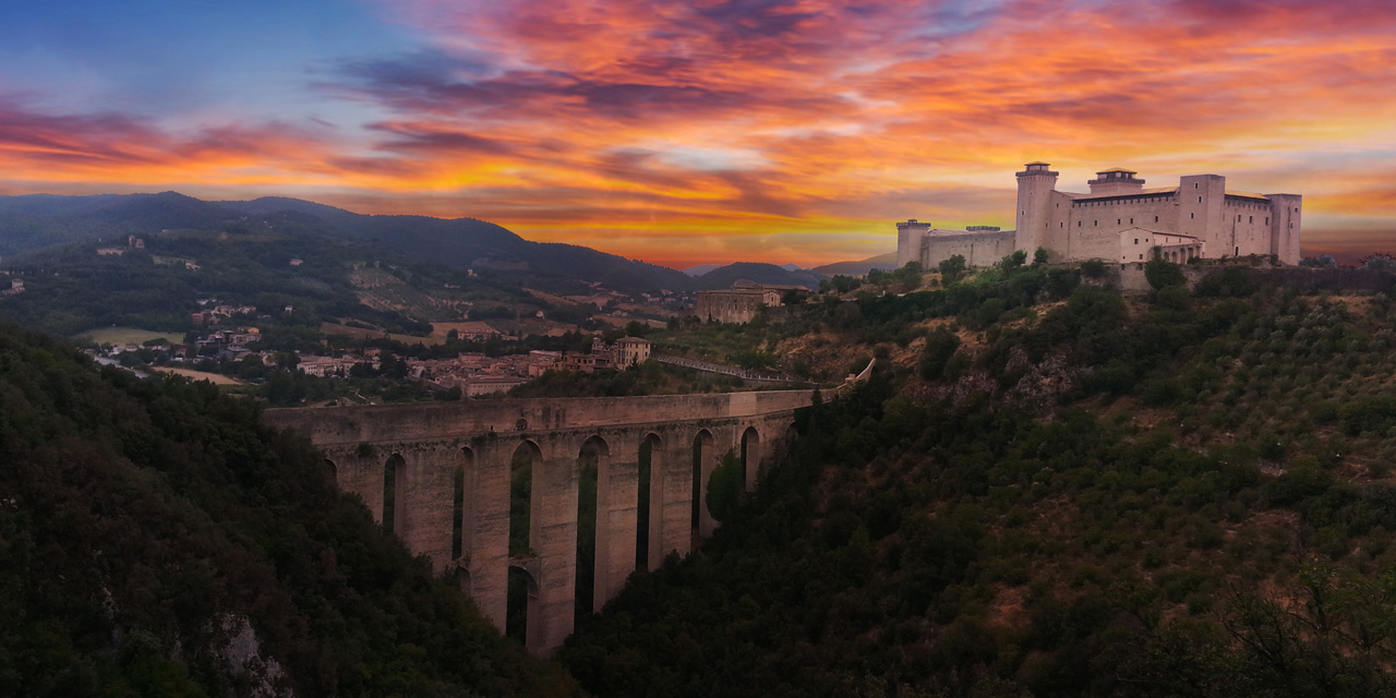
Spoleto -
Prati di Tivo
Saturday 11 May 2024 152km Altitude Gain 3850m
Total time: 4:02:16 Withdrawn: 1
Array( [0] => Array ( [type] => athletes [pos] => 1 [id] => 191 [name] => POGACAR Tadej [nome] => Tadej [cognome] => POGACAR [team] => UAE TEAM EMIRATES [sigla_team] => UAD [val] => 4:02:16 [distacco] => 0:00 [idx] => [localita] => [abbuono] => 0:10 ) [1] => Array ( [type] => athletes [pos] => 2 [id] => 41 [name] => MARTINEZ Daniel Felipe [nome] => Daniel Felipe [cognome] => MARTINEZ [team] => BORA - HANSGROHE [sigla_team] => BOH [val] => 4:02:16 [distacco] => 0:00 [idx] => [localita] => [abbuono] => 0:06 ) [2] => Array ( [type] => athletes [pos] => 3 [id] => 61 [name] => O'CONNOR Ben [nome] => Ben [cognome] => O'CONNOR [team] => DECATHLON AG2R LA MONDIALE TEAM [sigla_team] => DAT [val] => 4:02:16 [distacco] => 0:00 [idx] => [localita] => [abbuono] => 0:04 ) [3] => Array ( [type] => athletes [pos] => 4 [id] => 211 [name] => TIBERI Antonio [nome] => Antonio [cognome] => TIBERI [team] => BAHRAIN VICTORIOUS [sigla_team] => TBV [val] => 4:02:18 [distacco] => 0:02 [idx] => [localita] => [abbuono] => ) [4] => Array ( [type] => athletes [pos] => 5 [id] => 1 [name] => THOMAS Geraint [nome] => Geraint [cognome] => THOMAS [team] => INEOS GRENADIERS [sigla_team] => IGD [val] => 4:02:18 [distacco] => 0:02 [idx] => [localita] => [abbuono] => ) [5] => Array ( [type] => athletes [pos] => 6 [id] => 126 [name] => RUBIO Einer [nome] => Einer [cognome] => RUBIO [team] => MOVISTAR TEAM [sigla_team] => MOV [val] => 4:02:18 [distacco] => 0:02 [idx] => [localita] => [abbuono] => ) [6] => Array ( [type] => athletes [pos] => 7 [id] => 176 [name] => UIJTDEBROEKS Cian [nome] => Cian [cognome] => UIJTDEBROEKS [team] => TEAM VISMA - LEASE A BIKE [sigla_team] => TVL [val] => 4:02:18 [distacco] => 0:02 [idx] => [localita] => [abbuono] => ) [7] => Array ( [type] => athletes [pos] => 8 [id] => 2 [name] => ARENSMAN Thymen [nome] => Thymen [cognome] => ARENSMAN [team] => INEOS GRENADIERS [sigla_team] => IGD [val] => 4:02:27 [distacco] => 0:11 [idx] => [localita] => [abbuono] => ) [8] => Array ( [type] => athletes [pos] => 9 [id] => 187 [name] => STORER Michael [nome] => Michael [cognome] => STORER [team] => TUDOR PRO CYCLING TEAM [sigla_team] => TUD [val] => 4:02:29 [distacco] => 0:13 [idx] => [localita] => [abbuono] => ) [9] => Array ( [type] => athletes [pos] => 10 [id] => 62 [name] => BAUDIN Alex [nome] => Alex [cognome] => BAUDIN [team] => DECATHLON AG2R LA MONDIALE TEAM [sigla_team] => DAT [val] => 4:02:37 [distacco] => 0:21 [idx] => [localita] => [abbuono] => ) [10] => Array ( [type] => athletes [pos] => 11 [id] => 33 [name] => FORTUNATO Lorenzo [nome] => Lorenzo [cognome] => FORTUNATO [team] => ASTANA QAZAQSTAN TEAM [sigla_team] => AST [val] => 4:02:37 [distacco] => 0:21 [idx] => [localita] => [abbuono] => ) [11] => Array ( [type] => athletes [pos] => 12 [id] => 196 [name] => MAJKA Rafal [nome] => Rafal [cognome] => MAJKA [team] => UAE TEAM EMIRATES [sigla_team] => UAD [val] => 4:02:37 [distacco] => 0:21 [idx] => [localita] => [abbuono] => 0:01 ) [12] => Array ( [type] => athletes [pos] => 13 [id] => 201 [name] => POZZOVIVO Domenico [nome] => Domenico [cognome] => POZZOVIVO [team] => VF GROUP - BARDIANI CSF- FAIZANE' [sigla_team] => VBF [val] => 4:02:37 [distacco] => 0:21 [idx] => [localita] => [abbuono] => ) [13] => Array ( [type] => athletes [pos] => 14 [id] => 133 [name] => HIRT Jan [nome] => Jan [cognome] => HIRT [team] => SOUDAL QUICK - STEP [sigla_team] => SOQ [val] => 4:02:37 [distacco] => 0:21 [idx] => [localita] => [abbuono] => ) [14] => Array ( [type] => athletes [pos] => 15 [id] => 42 [name] => ALEOTTI Giovanni [nome] => Giovanni [cognome] => ALEOTTI [team] => BORA - HANSGROHE [sigla_team] => BOH [val] => 4:03:21 [distacco] => 01:05 [idx] => [localita] => [abbuono] => ) [15] => Array ( [type] => athletes [pos] => 16 [id] => 168 [name] => PIGANZOLI Davide [nome] => Davide [cognome] => PIGANZOLI [team] => TEAM POLTI KOMETA [sigla_team] => PTK [val] => 4:04:37 [distacco] => 02:21 [idx] => [localita] => [abbuono] => ) [16] => Array ( [type] => athletes [pos] => 17 [id] => 158 [name] => ZANA Filippo [nome] => Filippo [cognome] => ZANA [team] => TEAM JAYCO ALULA [sigla_team] => JAY [val] => 4:04:37 [distacco] => 02:21 [idx] => [localita] => [abbuono] => ) [17] => Array ( [type] => athletes [pos] => 18 [id] => 56 [name] => GESCHKE Simon [nome] => Simon [cognome] => GESCHKE [team] => COFIDIS [sigla_team] => COF [val] => 4:04:37 [distacco] => 02:21 [idx] => [localita] => [abbuono] => ) [18] => Array ( [type] => athletes [pos] => 19 [id] => 31 [name] => LUTSENKO Alexey [nome] => Alexey [cognome] => LUTSENKO [team] => ASTANA QAZAQSTAN TEAM [sigla_team] => AST [val] => 4:04:37 [distacco] => 02:21 [idx] => [localita] => [abbuono] => ) [19] => Array ( [type] => athletes [pos] => 20 [id] => 141 [name] => BARDET Romain [nome] => Romain [cognome] => BARDET [team] => TEAM DSM - FIRMENICH POSTNL [sigla_team] => DFP [val] => 4:04:37 [distacco] => 02:21 [idx] => [localita] => [abbuono] => 0:03 ) [20] => Array ( [type] => athletes [pos] => 21 [id] => 77 [name] => STEINHAUSER Georg [nome] => Georg [cognome] => STEINHAUSER [team] => EF EDUCATION - EASYPOST [sigla_team] => EFE [val] => 4:04:37 [distacco] => 02:21 [idx] => [localita] => [abbuono] => 0:02 ) [21] => Array ( [type] => athletes [pos] => 22 [id] => 64 [name] => PARET PEINTRE Valentin [nome] => Valentin [cognome] => PARET PEINTRE [team] => DECATHLON AG2R LA MONDIALE TEAM [sigla_team] => DAT [val] => 4:05:49 [distacco] => 03:33 [idx] => [localita] => [abbuono] => 0:03 ) [22] => Array ( [type] => athletes [pos] => 23 [id] => 71 [name] => CHAVES Esteban [nome] => Esteban [cognome] => CHAVES [team] => EF EDUCATION - EASYPOST [sigla_team] => EFE [val] => 4:05:55 [distacco] => 03:39 [idx] => [localita] => [abbuono] => ) [23] => Array ( [type] => athletes [pos] => 24 [id] => 114 [name] => GHEBREIGZABHIER Amanuel [nome] => Amanuel [cognome] => GHEBREIGZABHIER [team] => LIDL-TREK [sigla_team] => LTK [val] => 4:06:19 [distacco] => 04:03 [idx] => [localita] => [abbuono] => ) [24] => Array ( [type] => athletes [pos] => 25 [id] => 116 [name] => LOPEZ Juan Pedro [nome] => Juan Pedro [cognome] => LOPEZ [team] => LIDL-TREK [sigla_team] => LTK [val] => 4:06:19 [distacco] => 04:03 [idx] => [localita] => [abbuono] => ) [25] => Array ( [type] => athletes [pos] => 26 [id] => 26 [name] => RIES Michel [nome] => Michel [cognome] => RIES [team] => ARKEA - B&B HOTELS [sigla_team] => ARK [val] => 4:07:03 [distacco] => 04:47 [idx] => [localita] => [abbuono] => ) [26] => Array ( [type] => athletes [pos] => 27 [id] => 194 [name] => GROSSSCHARTNER Felix [nome] => Felix [cognome] => GROSSSCHARTNER [team] => UAE TEAM EMIRATES [sigla_team] => UAD [val] => 4:08:32 [distacco] => 06:16 [idx] => [localita] => [abbuono] => 0:02 ) [27] => Array ( [type] => athletes [pos] => 28 [id] => 47 [name] => SCHACHMANN Maximilian [nome] => Maximilian [cognome] => SCHACHMANN [team] => BORA - HANSGROHE [sigla_team] => BOH [val] => 4:08:47 [distacco] => 06:31 [idx] => [localita] => [abbuono] => ) [28] => Array ( [type] => athletes [pos] => 29 [id] => 58 [name] => WOOD Harrison [nome] => Harrison [cognome] => WOOD [team] => COFIDIS [sigla_team] => COF [val] => 4:09:33 [distacco] => 07:17 [idx] => [localita] => [abbuono] => ) [29] => Array ( [type] => athletes [pos] => 30 [id] => 53 [name] => CHAMPION Thomas [nome] => Thomas [cognome] => CHAMPION [team] => COFIDIS [sigla_team] => COF [val] => 4:09:33 [distacco] => 07:17 [idx] => [localita] => [abbuono] => ) [30] => Array ( [type] => athletes [pos] => 31 [id] => 202 [name] => COVILI Luca [nome] => Luca [cognome] => COVILI [team] => VF GROUP - BARDIANI CSF- FAIZANE' [sigla_team] => VBF [val] => 4:09:33 [distacco] => 07:17 [idx] => [localita] => [abbuono] => ) [31] => Array ( [type] => athletes [pos] => 32 [id] => 205 [name] => PELLIZZARI Giulio [nome] => Giulio [cognome] => PELLIZZARI [team] => VF GROUP - BARDIANI CSF- FAIZANE' [sigla_team] => VBF [val] => 4:09:33 [distacco] => 07:17 [idx] => [localita] => [abbuono] => ) [32] => Array ( [type] => athletes [pos] => 33 [id] => 143 [name] => HAMILTON Christopher [nome] => Christopher [cognome] => HAMILTON [team] => TEAM DSM - FIRMENICH POSTNL [sigla_team] => DFP [val] => 4:09:33 [distacco] => 07:17 [idx] => [localita] => [abbuono] => ) [33] => Array ( [type] => athletes [pos] => 34 [id] => 177 [name] => VALTER Attila [nome] => Attila [cognome] => VALTER [team] => TEAM VISMA - LEASE A BIKE [sigla_team] => TVL [val] => 4:10:06 [distacco] => 07:50 [idx] => [localita] => [abbuono] => ) [34] => Array ( [type] => athletes [pos] => 35 [id] => 92 [name] => CALMEJANE Lilian [nome] => Lilian [cognome] => CALMEJANE [team] => INTERMARCHE' - WANTY [sigla_team] => IWA [val] => 4:10:13 [distacco] => 07:57 [idx] => [localita] => [abbuono] => ) [35] => Array ( [type] => athletes [pos] => 36 [id] => 63 [name] => PARET PEINTRE Aurelien [nome] => Aurelien [cognome] => PARET PEINTRE [team] => DECATHLON AG2R LA MONDIALE TEAM [sigla_team] => DAT [val] => 4:11:45 [distacco] => 09:29 [idx] => [localita] => [abbuono] => ) [36] => Array ( [type] => athletes [pos] => 37 [id] => 214 [name] => CARUSO Damiano [nome] => Damiano [cognome] => CARUSO [team] => BAHRAIN VICTORIOUS [sigla_team] => TBV [val] => 4:11:54 [distacco] => 09:38 [idx] => [localita] => [abbuono] => ) [37] => Array ( [type] => athletes [pos] => 38 [id] => 216 [name] => ZAMBANINI Edoardo [nome] => Edoardo [cognome] => ZAMBANINI [team] => BAHRAIN VICTORIOUS [sigla_team] => TBV [val] => 4:11:54 [distacco] => 09:38 [idx] => [localita] => [abbuono] => ) [38] => Array ( [type] => athletes [pos] => 39 [id] => 36 [name] => PRONSKIY Vadim [nome] => Vadim [cognome] => PRONSKIY [team] => ASTANA QAZAQSTAN TEAM [sigla_team] => AST [val] => 4:11:54 [distacco] => 09:38 [idx] => [localita] => [abbuono] => ) [39] => Array ( [type] => athletes [pos] => 40 [id] => 78 [name] => VALGREN Michael [nome] => Michael [cognome] => VALGREN [team] => EF EDUCATION - EASYPOST [sigla_team] => EFE [val] => 4:13:24 [distacco] => 11:08 [idx] => [localita] => [abbuono] => ) [40] => Array ( [type] => athletes [pos] => 41 [id] => 203 [name] => FIORELLI Filippo [nome] => Filippo [cognome] => FIORELLI [team] => VF GROUP - BARDIANI CSF- FAIZANE' [sigla_team] => VBF [val] => 4:14:51 [distacco] => 12:35 [idx] => [localita] => [abbuono] => ) [41] => Array ( [type] => athletes [pos] => 42 [id] => 207 [name] => TONELLI Alessandro [nome] => Alessandro [cognome] => TONELLI [team] => VF GROUP - BARDIANI CSF- FAIZANE' [sigla_team] => VBF [val] => 4:14:51 [distacco] => 12:35 [idx] => [localita] => [abbuono] => ) [42] => Array ( [type] => athletes [pos] => 43 [id] => 37 [name] => SCARONI Christian [nome] => Christian [cognome] => SCARONI [team] => ASTANA QAZAQSTAN TEAM [sigla_team] => AST [val] => 4:14:51 [distacco] => 12:35 [idx] => [localita] => [abbuono] => ) [43] => Array ( [type] => athletes [pos] => 44 [id] => 35 [name] => MULUEBERHAN Henok [nome] => Henok [cognome] => MULUEBERHAN [team] => ASTANA QAZAQSTAN TEAM [sigla_team] => AST [val] => 4:14:51 [distacco] => 12:35 [idx] => [localita] => [abbuono] => ) [44] => Array ( [type] => athletes [pos] => 45 [id] => 6 [name] => SHEFFIELD Magnus [nome] => Magnus [cognome] => SHEFFIELD [team] => INEOS GRENADIERS [sigla_team] => IGD [val] => 4:14:51 [distacco] => 12:35 [idx] => [localita] => [abbuono] => 0:01 ) [45] => Array ( [type] => athletes [pos] => 46 [id] => 5 [name] => NARVAEZ Jhonatan [nome] => Jhonatan [cognome] => NARVAEZ [team] => INEOS GRENADIERS [sigla_team] => IGD [val] => 4:14:51 [distacco] => 12:35 [idx] => [localita] => [abbuono] => ) [46] => Array ( [type] => athletes [pos] => 47 [id] => 147 [name] => VERMAERKE Kevin [nome] => Kevin [cognome] => VERMAERKE [team] => TEAM DSM - FIRMENICH POSTNL [sigla_team] => DFP [val] => 4:14:51 [distacco] => 12:35 [idx] => [localita] => [abbuono] => ) [47] => Array ( [type] => athletes [pos] => 48 [id] => 121 [name] => QUINTANA Nairo [nome] => Nairo [cognome] => QUINTANA [team] => MOVISTAR TEAM [sigla_team] => MOV [val] => 4:14:51 [distacco] => 12:35 [idx] => [localita] => [abbuono] => ) [48] => Array ( [type] => athletes [pos] => 49 [id] => 68 [name] => WARBASSE Lawrence [nome] => Lawrence [cognome] => WARBASSE [team] => DECATHLON AG2R LA MONDIALE TEAM [sigla_team] => DAT [val] => 4:14:51 [distacco] => 12:35 [idx] => [localita] => [abbuono] => ) [49] => Array ( [type] => athletes [pos] => 50 [id] => 7 [name] => SWIFT Ben [nome] => Ben [cognome] => SWIFT [team] => INEOS GRENADIERS [sigla_team] => IGD [val] => 4:14:51 [distacco] => 12:35 [idx] => [localita] => [abbuono] => ) [50] => Array ( [type] => athletes [pos] => 51 [id] => 14 [name] => HERMANS Quinten [nome] => Quinten [cognome] => HERMANS [team] => ALPECIN - DECEUNINCK [sigla_team] => ADC [val] => 4:14:51 [distacco] => 12:35 [idx] => [localita] => [abbuono] => ) [51] => Array ( [type] => athletes [pos] => 52 [id] => 112 [name] => BAGIOLI Andrea [nome] => Andrea [cognome] => BAGIOLI [team] => LIDL-TREK [sigla_team] => LTK [val] => 4:16:22 [distacco] => 14:06 [idx] => [localita] => [abbuono] => ) [52] => Array ( [type] => athletes [pos] => 53 [id] => 15 [name] => JANSSENS Jimmy [nome] => Jimmy [cognome] => JANSSENS [team] => ALPECIN - DECEUNINCK [sigla_team] => ADC [val] => 4:16:22 [distacco] => 14:06 [idx] => [localita] => [abbuono] => ) [53] => Array ( [type] => athletes [pos] => 54 [id] => 175 [name] => TRATNIK Jan [nome] => Jan [cognome] => TRATNIK [team] => TEAM VISMA - LEASE A BIKE [sigla_team] => TVL [val] => 4:16:31 [distacco] => 14:15 [idx] => [localita] => [abbuono] => ) [54] => Array ( [type] => athletes [pos] => 55 [id] => 38 [name] => VELASCO Simone [nome] => Simone [cognome] => VELASCO [team] => ASTANA QAZAQSTAN TEAM [sigla_team] => AST [val] => 4:16:39 [distacco] => 14:23 [idx] => [localita] => [abbuono] => ) [55] => Array ( [type] => athletes [pos] => 56 [id] => 93 [name] => COLLEONI Kevin [nome] => Kevin [cognome] => COLLEONI [team] => INTERMARCHE' - WANTY [sigla_team] => IWA [val] => 4:16:39 [distacco] => 14:23 [idx] => [localita] => [abbuono] => ) [56] => Array ( [type] => athletes [pos] => 57 [id] => 13 [name] => CONCI Nicola [nome] => Nicola [cognome] => CONCI [team] => ALPECIN - DECEUNINCK [sigla_team] => ADC [val] => 4:16:39 [distacco] => 14:23 [idx] => [localita] => [abbuono] => ) [57] => Array ( [type] => athletes [pos] => 58 [id] => 163 [name] => BAIS Mattia [nome] => Mattia [cognome] => BAIS [team] => TEAM POLTI KOMETA [sigla_team] => PTK [val] => 4:16:39 [distacco] => 14:23 [idx] => [localita] => [abbuono] => ) [58] => Array ( [type] => athletes [pos] => 59 [id] => 8 [name] => SWIFT Connor [nome] => Connor [cognome] => SWIFT [team] => INEOS GRENADIERS [sigla_team] => IGD [val] => 4:16:39 [distacco] => 14:23 [idx] => [localita] => [abbuono] => ) [59] => Array ( [type] => athletes [pos] => 60 [id] => 188 [name] => STORK Florian [nome] => Florian [cognome] => STORK [team] => TUDOR PRO CYCLING TEAM [sigla_team] => TUD [val] => 4:16:39 [distacco] => 14:23 [idx] => [localita] => [abbuono] => ) [60] => Array ( [type] => athletes [pos] => 61 [id] => 138 [name] => VANSEVENANT Mauri [nome] => Mauri [cognome] => VANSEVENANT [team] => SOUDAL QUICK - STEP [sigla_team] => SOQ [val] => 4:16:39 [distacco] => 14:23 [idx] => [localita] => [abbuono] => ) [61] => Array ( [type] => athletes [pos] => 62 [id] => 51 [name] => OLDANI Stefano [nome] => Stefano [cognome] => OLDANI [team] => COFIDIS [sigla_team] => COF [val] => 4:16:39 [distacco] => 14:23 [idx] => [localita] => [abbuono] => ) [62] => Array ( [type] => athletes [pos] => 63 [id] => 103 [name] => FRIGO Marco [nome] => Marco [cognome] => FRIGO [team] => ISRAEL - PREMIER TECH [sigla_team] => IPT [val] => 4:16:39 [distacco] => 14:23 [idx] => [localita] => [abbuono] => ) [63] => Array ( [type] => athletes [pos] => 64 [id] => 145 [name] => LEEMREIZE Gijs [nome] => Gijs [cognome] => LEEMREIZE [team] => TEAM DSM - FIRMENICH POSTNL [sigla_team] => DFP [val] => 4:16:39 [distacco] => 14:23 [idx] => [localita] => [abbuono] => ) [64] => Array ( [type] => athletes [pos] => 65 [id] => 102 [name] => CLARKE Simon [nome] => Simon [cognome] => CLARKE [team] => ISRAEL - PREMIER TECH [sigla_team] => IPT [val] => 4:16:39 [distacco] => 14:23 [idx] => [localita] => [abbuono] => ) [65] => Array ( [type] => athletes [pos] => 66 [id] => 107 [name] => SCHULTZ Nicholas [nome] => Nicholas [cognome] => SCHULTZ [team] => ISRAEL - PREMIER TECH [sigla_team] => IPT [val] => 4:16:39 [distacco] => 14:23 [idx] => [localita] => [abbuono] => ) [66] => Array ( [type] => athletes [pos] => 67 [id] => 48 [name] => VAN POPPEL Danny [nome] => Danny [cognome] => VAN POPPEL [team] => BORA - HANSGROHE [sigla_team] => BOH [val] => 4:16:39 [distacco] => 14:23 [idx] => [localita] => [abbuono] => ) [67] => Array ( [type] => athletes [pos] => 68 [id] => 73 [name] => DE BOD Stefan [nome] => Stefan [cognome] => DE BOD [team] => EF EDUCATION - EASYPOST [sigla_team] => EFE [val] => 4:16:39 [distacco] => 14:23 [idx] => [localita] => [abbuono] => ) [68] => Array ( [type] => athletes [pos] => 69 [id] => 66 [name] => TRONCHON Bastien [nome] => Bastien [cognome] => TRONCHON [team] => DECATHLON AG2R LA MONDIALE TEAM [sigla_team] => DAT [val] => 4:16:39 [distacco] => 14:23 [idx] => [localita] => [abbuono] => ) [69] => Array ( [type] => athletes [pos] => 70 [id] => 217 [name] => SUTTERLIN Jasha [nome] => Jasha [cognome] => SUTTERLIN [team] => BAHRAIN VICTORIOUS [sigla_team] => TBV [val] => 4:16:39 [distacco] => 14:23 [idx] => [localita] => [abbuono] => ) [70] => Array ( [type] => athletes [pos] => 71 [id] => 165 [name] => MAESTRI Mirco [nome] => Mirco [cognome] => MAESTRI [team] => TEAM POLTI KOMETA [sigla_team] => PTK [val] => 4:17:45 [distacco] => 15:29 [idx] => [localita] => [abbuono] => ) [71] => Array ( [type] => athletes [pos] => 72 [id] => 151 [name] => DE MARCHI Alessandro [nome] => Alessandro [cognome] => DE MARCHI [team] => TEAM JAYCO ALULA [sigla_team] => JAY [val] => 4:18:01 [distacco] => 15:45 [idx] => [localita] => [abbuono] => ) [72] => Array ( [type] => athletes [pos] => 73 [id] => 136 [name] => SERRY Pieter [nome] => Pieter [cognome] => SERRY [team] => SOUDAL QUICK - STEP [sigla_team] => SOQ [val] => 4:18:44 [distacco] => 16:28 [idx] => [localita] => [abbuono] => ) [73] => Array ( [type] => athletes [pos] => 74 [id] => 127 [name] => SANCHEZ Pelayo [nome] => Pelayo [cognome] => SANCHEZ [team] => MOVISTAR TEAM [sigla_team] => MOV [val] => 4:19:22 [distacco] => 17:06 [idx] => [localita] => [abbuono] => ) [74] => Array ( [type] => athletes [pos] => 75 [id] => 55 [name] => FERNANDEZ Ruben [nome] => Ruben [cognome] => FERNANDEZ [team] => COFIDIS [sigla_team] => COF [val] => 4:19:22 [distacco] => 17:06 [idx] => [localita] => [abbuono] => ) [75] => Array ( [type] => athletes [pos] => 76 [id] => 195 [name] => LAENGEN Vegard Stake [nome] => Vegard Stake [cognome] => LAENGEN [team] => UAE TEAM EMIRATES [sigla_team] => UAD [val] => 4:19:22 [distacco] => 17:06 [idx] => [localita] => [abbuono] => ) [76] => Array ( [type] => athletes [pos] => 77 [id] => 122 [name] => BARTA William [nome] => William [cognome] => BARTA [team] => MOVISTAR TEAM [sigla_team] => MOV [val] => 4:19:22 [distacco] => 17:06 [idx] => [localita] => [abbuono] => ) [77] => Array ( [type] => athletes [pos] => 78 [id] => 212 [name] => KEPPLINGER Rainer [nome] => Rainer [cognome] => KEPPLINGER [team] => BAHRAIN VICTORIOUS [sigla_team] => TBV [val] => 4:19:22 [distacco] => 17:06 [idx] => [localita] => [abbuono] => ) [78] => Array ( [type] => athletes [pos] => 79 [id] => 128 [name] => TORRES Albert [nome] => Albert [cognome] => TORRES [team] => MOVISTAR TEAM [sigla_team] => MOV [val] => 4:19:22 [distacco] => 17:06 [idx] => [localita] => [abbuono] => ) [79] => Array ( [type] => athletes [pos] => 80 [id] => 131 [name] => ALAPHILIPPE Julian [nome] => Julian [cognome] => ALAPHILIPPE [team] => SOUDAL QUICK - STEP [sigla_team] => SOQ [val] => 4:19:38 [distacco] => 17:22 [idx] => [localita] => [abbuono] => ) [80] => Array ( [type] => athletes [pos] => 81 [id] => 28 [name] => VERRE Alessandro [nome] => Alessandro [cognome] => VERRE [team] => ARKEA - B&B HOTELS [sigla_team] => ARK [val] => 4:20:01 [distacco] => 17:45 [idx] => [localita] => [abbuono] => ) [81] => Array ( [type] => athletes [pos] => 82 [id] => 204 [name] => MARCELLUSI Martin [nome] => Martin [cognome] => MARCELLUSI [team] => VF GROUP - BARDIANI CSF- FAIZANE' [sigla_team] => VBF [val] => 4:20:19 [distacco] => 18:03 [idx] => [localita] => [abbuono] => ) [82] => Array ( [type] => athletes [pos] => 83 [id] => 198 [name] => NOVAK Domen [nome] => Domen [cognome] => NOVAK [team] => UAE TEAM EMIRATES [sigla_team] => UAD [val] => 4:20:22 [distacco] => 18:06 [idx] => [localita] => [abbuono] => ) [83] => Array ( [type] => athletes [pos] => 84 [id] => 156 [name] => PLAPP Lucas [nome] => Lucas [cognome] => PLAPP [team] => TEAM JAYCO ALULA [sigla_team] => JAY [val] => 4:22:33 [distacco] => 20:17 [idx] => [localita] => [abbuono] => ) [84] => Array ( [type] => athletes [pos] => 85 [id] => 193 [name] => BJERG Mikkel [nome] => Mikkel [cognome] => BJERG [team] => UAE TEAM EMIRATES [sigla_team] => UAD [val] => 4:23:21 [distacco] => 21:05 [idx] => [localita] => [abbuono] => ) [85] => Array ( [type] => athletes [pos] => 86 [id] => 3 [name] => FOSS Tobias [nome] => Tobias [cognome] => FOSS [team] => INEOS GRENADIERS [sigla_team] => IGD [val] => 4:24:21 [distacco] => 22:05 [idx] => [localita] => [abbuono] => ) [86] => Array ( [type] => athletes [pos] => 87 [id] => 43 [name] => GAMPER Patrick [nome] => Patrick [cognome] => GAMPER [team] => BORA - HANSGROHE [sigla_team] => BOH [val] => 4:27:01 [distacco] => 24:45 [idx] => [localita] => [abbuono] => ) [87] => Array ( [type] => athletes [pos] => 88 [id] => 23 [name] => COSTIOU Ewen [nome] => Ewen [cognome] => COSTIOU [team] => ARKEA - B&B HOTELS [sigla_team] => ARK [val] => 4:27:01 [distacco] => 24:45 [idx] => [localita] => [abbuono] => ) [88] => Array ( [type] => athletes [pos] => 89 [id] => 12 [name] => BAYER Tobias [nome] => Tobias [cognome] => BAYER [team] => ALPECIN - DECEUNINCK [sigla_team] => ADC [val] => 4:28:29 [distacco] => 26:13 [idx] => [localita] => [abbuono] => ) [89] => Array ( [type] => athletes [pos] => 90 [id] => 17 [name] => PLANCKAERT Edward [nome] => Edward [cognome] => PLANCKAERT [team] => ALPECIN - DECEUNINCK [sigla_team] => ADC [val] => 4:28:29 [distacco] => 26:13 [idx] => [localita] => [abbuono] => ) [90] => Array ( [type] => athletes [pos] => 91 [id] => 11 [name] => GROVES Kaden [nome] => Kaden [cognome] => GROVES [team] => ALPECIN - DECEUNINCK [sigla_team] => ADC [val] => 4:28:29 [distacco] => 26:13 [idx] => [localita] => [abbuono] => ) [91] => Array ( [type] => athletes [pos] => 92 [id] => 67 [name] => VENDRAME Andrea [nome] => Andrea [cognome] => VENDRAME [team] => DECATHLON AG2R LA MONDIALE TEAM [sigla_team] => DAT [val] => 4:28:29 [distacco] => 26:13 [idx] => [localita] => [abbuono] => ) [92] => Array ( [type] => athletes [pos] => 93 [id] => 65 [name] => TOUZE Damien [nome] => Damien [cognome] => TOUZE [team] => DECATHLON AG2R LA MONDIALE TEAM [sigla_team] => DAT [val] => 4:28:29 [distacco] => 26:13 [idx] => [localita] => [abbuono] => ) [93] => Array ( [type] => athletes [pos] => 94 [id] => 85 [name] => GERMANI Lorenzo [nome] => Lorenzo [cognome] => GERMANI [team] => GROUPAMA - FDJ [sigla_team] => GFC [val] => 4:28:29 [distacco] => 26:13 [idx] => [localita] => [abbuono] => ) [94] => Array ( [type] => athletes [pos] => 95 [id] => 178 [name] => VAN DIJKE Tim [nome] => Tim [cognome] => VAN DIJKE [team] => TEAM VISMA - LEASE A BIKE [sigla_team] => TVL [val] => 4:28:29 [distacco] => 26:13 [idx] => [localita] => [abbuono] => ) [95] => Array ( [type] => athletes [pos] => 96 [id] => 117 [name] => STUYVEN Jasper [nome] => Jasper [cognome] => STUYVEN [team] => LIDL-TREK [sigla_team] => LTK [val] => 4:28:29 [distacco] => 26:13 [idx] => [localita] => [abbuono] => ) [96] => Array ( [type] => athletes [pos] => 97 [id] => 98 [name] => VAN SINTMAARTENSDIJK Roel [nome] => Roel [cognome] => VAN SINTMAARTENSDIJK [team] => INTERMARCHE' - WANTY [sigla_team] => IWA [val] => 4:28:29 [distacco] => 26:13 [idx] => [localita] => [abbuono] => ) [97] => Array ( [type] => athletes [pos] => 98 [id] => 97 [name] => SMITH Dion [nome] => Dion [cognome] => SMITH [team] => INTERMARCHE' - WANTY [sigla_team] => IWA [val] => 4:28:29 [distacco] => 26:13 [idx] => [localita] => [abbuono] => ) [98] => Array ( [type] => athletes [pos] => 99 [id] => 81 [name] => PITHIE Laurence [nome] => Laurence [cognome] => PITHIE [team] => GROUPAMA - FDJ [sigla_team] => GFC [val] => 4:29:12 [distacco] => 26:56 [idx] => [localita] => [abbuono] => ) [99] => Array ( [type] => athletes [pos] => 100 [id] => 82 [name] => ASKEY Lewis [nome] => Lewis [cognome] => ASKEY [team] => GROUPAMA - FDJ [sigla_team] => GFC [val] => 4:29:12 [distacco] => 26:56 [idx] => [localita] => [abbuono] => ) [100] => Array ( [type] => athletes [pos] => 101 [id] => 84 [name] => DAVY Clement [nome] => Clement [cognome] => DAVY [team] => GROUPAMA - FDJ [sigla_team] => GFC [val] => 4:32:14 [distacco] => 29:58 [idx] => [localita] => [abbuono] => ) [101] => Array ( [type] => athletes [pos] => 102 [id] => 83 [name] => BARTHE Cyril [nome] => Cyril [cognome] => BARTHE [team] => GROUPAMA - FDJ [sigla_team] => GFC [val] => 4:32:14 [distacco] => 29:58 [idx] => [localita] => [abbuono] => ) [102] => Array ( [type] => athletes [pos] => 103 [id] => 181 [name] => TRENTIN Matteo [nome] => Matteo [cognome] => TRENTIN [team] => TUDOR PRO CYCLING TEAM [sigla_team] => TUD [val] => 4:32:14 [distacco] => 29:58 [idx] => [localita] => [abbuono] => ) [103] => Array ( [type] => athletes [pos] => 104 [id] => 186 [name] => MAYRHOFER Marius [nome] => Marius [cognome] => MAYRHOFER [team] => TUDOR PRO CYCLING TEAM [sigla_team] => TUD [val] => 4:32:14 [distacco] => 29:58 [idx] => [localita] => [abbuono] => ) [104] => Array ( [type] => athletes [pos] => 105 [id] => 34 [name] => KANTER Max [nome] => Max [cognome] => KANTER [team] => ASTANA QAZAQSTAN TEAM [sigla_team] => AST [val] => 4:32:14 [distacco] => 29:58 [idx] => [localita] => [abbuono] => ) [105] => Array ( [type] => athletes [pos] => 106 [id] => 215 [name] => PASQUALON Andrea [nome] => Andrea [cognome] => PASQUALON [team] => BAHRAIN VICTORIOUS [sigla_team] => TBV [val] => 4:32:14 [distacco] => 29:58 [idx] => [localita] => [abbuono] => ) [106] => Array ( [type] => athletes [pos] => 107 [id] => 184 [name] => KAMP Alexander [nome] => Alexander [cognome] => KAMP [team] => TUDOR PRO CYCLING TEAM [sigla_team] => TUD [val] => 4:32:14 [distacco] => 29:58 [idx] => [localita] => [abbuono] => ) [107] => Array ( [type] => athletes [pos] => 108 [id] => 54 [name] => DEBEAUMARCHE Nicolas [nome] => Nicolas [cognome] => DEBEAUMARCHE [team] => COFIDIS [sigla_team] => COF [val] => 4:32:14 [distacco] => 29:58 [idx] => [localita] => [abbuono] => ) [108] => Array ( [type] => athletes [pos] => 109 [id] => 22 [name] => BARRE Louis [nome] => Louis [cognome] => BARRE [team] => ARKEA - B&B HOTELS [sigla_team] => ARK [val] => 4:32:14 [distacco] => 29:58 [idx] => [localita] => [abbuono] => ) [109] => Array ( [type] => athletes [pos] => 110 [id] => 162 [name] => BAIS Davide [nome] => Davide [cognome] => BAIS [team] => TEAM POLTI KOMETA [sigla_team] => PTK [val] => 4:32:14 [distacco] => 29:58 [idx] => [localita] => [abbuono] => ) [110] => Array ( [type] => athletes [pos] => 111 [id] => 161 [name] => FABBRO Matteo [nome] => Matteo [cognome] => FABBRO [team] => TEAM POLTI KOMETA [sigla_team] => PTK [val] => 4:32:14 [distacco] => 29:58 [idx] => [localita] => [abbuono] => ) [111] => Array ( [type] => athletes [pos] => 112 [id] => 32 [name] => BALLERINI Davide [nome] => Davide [cognome] => BALLERINI [team] => ASTANA QAZAQSTAN TEAM [sigla_team] => AST [val] => 4:32:29 [distacco] => 30:13 [idx] => [localita] => [abbuono] => ) [112] => Array ( [type] => athletes [pos] => 113 [id] => 57 [name] => THOMAS Benjamin [nome] => Benjamin [cognome] => THOMAS [team] => COFIDIS [sigla_team] => COF [val] => 4:33:18 [distacco] => 31:02 [idx] => [localita] => [abbuono] => ) [113] => Array ( [type] => athletes [pos] => 114 [id] => 154 [name] => HEPBURN Michael [nome] => Michael [cognome] => HEPBURN [team] => TEAM JAYCO ALULA [sigla_team] => JAY [val] => 4:33:30 [distacco] => 31:14 [idx] => [localita] => [abbuono] => ) [114] => Array ( [type] => athletes [pos] => 115 [id] => 172 [name] => AFFINI Edoardo [nome] => Edoardo [cognome] => AFFINI [team] => TEAM VISMA - LEASE A BIKE [sigla_team] => TVL [val] => 4:33:30 [distacco] => 31:14 [idx] => [localita] => [abbuono] => ) [115] => Array ( [type] => athletes [pos] => 116 [id] => 25 [name] => GRONDIN Donavan [nome] => Donavan [cognome] => GRONDIN [team] => ARKEA - B&B HOTELS [sigla_team] => ARK [val] => 4:33:30 [distacco] => 31:14 [idx] => [localita] => [abbuono] => ) [116] => Array ( [type] => athletes [pos] => 117 [id] => 104 [name] => HOFSTETTER Hugo [nome] => Hugo [cognome] => HOFSTETTER [team] => ISRAEL - PREMIER TECH [sigla_team] => IPT [val] => 4:33:30 [distacco] => 31:14 [idx] => [localita] => [abbuono] => ) [117] => Array ( [type] => athletes [pos] => 118 [id] => 46 [name] => MULLEN Ryan [nome] => Ryan [cognome] => MULLEN [team] => BORA - HANSGROHE [sigla_team] => BOH [val] => 4:33:30 [distacco] => 31:14 [idx] => [localita] => [abbuono] => ) [118] => Array ( [type] => athletes [pos] => 119 [id] => 18 [name] => VAN DEN BOSSCHE Fabio [nome] => Fabio [cognome] => VAN DEN BOSSCHE [team] => ALPECIN - DECEUNINCK [sigla_team] => ADC [val] => 4:33:38 [distacco] => 31:22 [idx] => [localita] => [abbuono] => ) [119] => Array ( [type] => athletes [pos] => 120 [id] => 185 [name] => KRIEGER Alexander [nome] => Alexander [cognome] => KRIEGER [team] => TUDOR PRO CYCLING TEAM [sigla_team] => TUD [val] => 4:34:51 [distacco] => 32:35 [idx] => [localita] => [abbuono] => ) [120] => Array ( [type] => athletes [pos] => 121 [id] => 44 [name] => KOCH Jonas [nome] => Jonas [cognome] => KOCH [team] => BORA - HANSGROHE [sigla_team] => BOH [val] => 4:34:51 [distacco] => 32:35 [idx] => [localita] => [abbuono] => ) [121] => Array ( [type] => athletes [pos] => 122 [id] => 206 [name] => TAROZZI Manuele [nome] => Manuele [cognome] => TAROZZI [team] => VF GROUP - BARDIANI CSF- FAIZANE' [sigla_team] => VBF [val] => 4:34:51 [distacco] => 32:35 [idx] => [localita] => [abbuono] => ) [122] => Array ( [type] => athletes [pos] => 123 [id] => 94 [name] => DE POOTER Dries [nome] => Dries [cognome] => DE POOTER [team] => INTERMARCHE' - WANTY [sigla_team] => IWA [val] => 4:36:25 [distacco] => 34:09 [idx] => [localita] => [abbuono] => ) [123] => Array ( [type] => athletes [pos] => 124 [id] => 21 [name] => BIERMANS Jenthe [nome] => Jenthe [cognome] => BIERMANS [team] => ARKEA - B&B HOTELS [sigla_team] => ARK [val] => 4:36:25 [distacco] => 34:09 [idx] => [localita] => [abbuono] => ) [124] => Array ( [type] => athletes [pos] => 125 [id] => 197 [name] => MOLANO Juan Sebastian [nome] => Juan Sebastian [cognome] => MOLANO [team] => UAE TEAM EMIRATES [sigla_team] => UAD [val] => 4:39:28 [distacco] => 37:12 [idx] => [localita] => [abbuono] => ) [125] => Array ( [type] => athletes [pos] => 126 [id] => 192 [name] => OLIVEIRA Rui [nome] => Rui [cognome] => OLIVEIRA [team] => UAE TEAM EMIRATES [sigla_team] => UAD [val] => 4:39:28 [distacco] => 37:12 [idx] => [localita] => [abbuono] => ) [126] => Array ( [type] => athletes [pos] => 127 [id] => 24 [name] => DEKKER David [nome] => David [cognome] => DEKKER [team] => ARKEA - B&B HOTELS [sigla_team] => ARK [val] => 4:41:22 [distacco] => 39:06 [idx] => [localita] => [abbuono] => ) [127] => Array ( [type] => athletes [pos] => 128 [id] => 115 [name] => HOOLE Daan [nome] => Daan [cognome] => HOOLE [team] => LIDL-TREK [sigla_team] => LTK [val] => 4:41:22 [distacco] => 39:06 [idx] => [localita] => [abbuono] => ) [128] => Array ( [type] => athletes [pos] => 129 [id] => 76 [name] => PICCOLO Andrea [nome] => Andrea [cognome] => PICCOLO [team] => EF EDUCATION - EASYPOST [sigla_team] => EFE [val] => 4:41:22 [distacco] => 39:06 [idx] => [localita] => [abbuono] => ) [129] => Array ( [type] => athletes [pos] => 130 [id] => 95 [name] => MIHKELS Madis [nome] => Madis [cognome] => MIHKELS [team] => INTERMARCHE' - WANTY [sigla_team] => IWA [val] => 4:41:22 [distacco] => 39:06 [idx] => [localita] => [abbuono] => ) [130] => Array ( [type] => athletes [pos] => 131 [id] => 27 [name] => RIOU Alan [nome] => Alan [cognome] => RIOU [team] => ARKEA - B&B HOTELS [sigla_team] => ARK [val] => 4:41:22 [distacco] => 39:06 [idx] => [localita] => [abbuono] => ) [131] => Array ( [type] => athletes [pos] => 132 [id] => 125 [name] => MILESI Lorenzo [nome] => Lorenzo [cognome] => MILESI [team] => MOVISTAR TEAM [sigla_team] => MOV [val] => 4:41:22 [distacco] => 39:06 [idx] => [localita] => [abbuono] => ) [132] => Array ( [type] => athletes [pos] => 133 [id] => 16 [name] => KIELICH Timo [nome] => Timo [cognome] => KIELICH [team] => ALPECIN - DECEUNINCK [sigla_team] => ADC [val] => 4:41:22 [distacco] => 39:06 [idx] => [localita] => [abbuono] => ) [133] => Array ( [type] => athletes [pos] => 134 [id] => 135 [name] => MERLIER Tim [nome] => Tim [cognome] => MERLIER [team] => SOUDAL QUICK - STEP [sigla_team] => SOQ [val] => 4:41:22 [distacco] => 39:06 [idx] => [localita] => [abbuono] => ) [134] => Array ( [type] => athletes [pos] => 135 [id] => 137 [name] => VAN LERBERGHE Bert [nome] => Bert [cognome] => VAN LERBERGHE [team] => SOUDAL QUICK - STEP [sigla_team] => SOQ [val] => 4:41:22 [distacco] => 39:06 [idx] => [localita] => [abbuono] => ) [135] => Array ( [type] => athletes [pos] => 136 [id] => 164 [name] => LONARDI Giovanni [nome] => Giovanni [cognome] => LONARDI [team] => TEAM POLTI KOMETA [sigla_team] => PTK [val] => 4:41:22 [distacco] => 39:06 [idx] => [localita] => [abbuono] => ) [136] => Array ( [type] => athletes [pos] => 137 [id] => 134 [name] => LAMPERTI Luke [nome] => Luke [cognome] => LAMPERTI [team] => SOUDAL QUICK - STEP [sigla_team] => SOQ [val] => 4:41:22 [distacco] => 39:06 [idx] => [localita] => [abbuono] => ) [137] => Array ( [type] => athletes [pos] => 138 [id] => 157 [name] => WALSCHEID Maximilian [nome] => Maximilian [cognome] => WALSCHEID [team] => TEAM JAYCO ALULA [sigla_team] => JAY [val] => 4:41:22 [distacco] => 39:06 [idx] => [localita] => [abbuono] => ) [138] => Array ( [type] => athletes [pos] => 139 [id] => 153 [name] => EWAN Caleb [nome] => Caleb [cognome] => EWAN [team] => TEAM JAYCO ALULA [sigla_team] => JAY [val] => 4:41:22 [distacco] => 39:06 [idx] => [localita] => [abbuono] => ) [139] => Array ( [type] => athletes [pos] => 140 [id] => 182 [name] => DAINESE Alberto [nome] => Alberto [cognome] => DAINESE [team] => TUDOR PRO CYCLING TEAM [sigla_team] => TUD [val] => 4:41:22 [distacco] => 39:06 [idx] => [localita] => [abbuono] => ) [140] => Array ( [type] => athletes [pos] => 141 [id] => 111 [name] => MILAN Jonathan [nome] => Jonathan [cognome] => MILAN [team] => LIDL-TREK [sigla_team] => LTK [val] => 4:41:22 [distacco] => 39:06 [idx] => [localita] => [abbuono] => ) [141] => Array ( [type] => athletes [pos] => 142 [id] => 123 [name] => CIMOLAI Davide [nome] => Davide [cognome] => CIMOLAI [team] => MOVISTAR TEAM [sigla_team] => MOV [val] => 4:41:22 [distacco] => 39:06 [idx] => [localita] => [abbuono] => ) [142] => Array ( [type] => athletes [pos] => 143 [id] => 167 [name] => PIETROBON Andrea [nome] => Andrea [cognome] => PIETROBON [team] => TEAM POLTI KOMETA [sigla_team] => PTK [val] => 4:41:22 [distacco] => 39:06 [idx] => [localita] => [abbuono] => ) [143] => Array ( [type] => athletes [pos] => 144 [id] => 208 [name] => ZANONCELLO Enrico [nome] => Enrico [cognome] => ZANONCELLO [team] => VF GROUP - BARDIANI CSF- FAIZANE' [sigla_team] => VBF [val] => 4:41:22 [distacco] => 39:06 [idx] => [localita] => [abbuono] => ) [144] => Array ( [type] => athletes [pos] => 145 [id] => 109 [name] => VERNON Ethan [nome] => Ethan [cognome] => VERNON [team] => ISRAEL - PREMIER TECH [sigla_team] => IPT [val] => 4:41:22 [distacco] => 39:06 [idx] => [localita] => [abbuono] => ) [145] => Array ( [type] => athletes [pos] => 146 [id] => 75 [name] => HONORE' Frolich Mikkel [nome] => Frolich Mikkel [cognome] => HONORE' [team] => EF EDUCATION - EASYPOST [sigla_team] => EFE [val] => 4:41:22 [distacco] => 39:06 [idx] => [localita] => [abbuono] => ) [146] => Array ( [type] => athletes [pos] => 147 [id] => 72 [name] => CEPEDA Jefferson [nome] => Jefferson [cognome] => CEPEDA [team] => EF EDUCATION - EASYPOST [sigla_team] => EFE [val] => 4:41:22 [distacco] => 39:06 [idx] => [localita] => [abbuono] => ) [147] => Array ( [type] => athletes [pos] => 148 [id] => 174 [name] => KOOIJ Olav [nome] => Olav [cognome] => KOOIJ [team] => TEAM VISMA - LEASE A BIKE [sigla_team] => TVL [val] => 4:41:22 [distacco] => 39:06 [idx] => [localita] => [abbuono] => ) [148] => Array ( [type] => athletes [pos] => 149 [id] => 87 [name] => LIENHARD Fabian [nome] => Fabian [cognome] => LIENHARD [team] => GROUPAMA - FDJ [sigla_team] => GFC [val] => 4:41:22 [distacco] => 39:06 [idx] => [localita] => [abbuono] => ) [149] => Array ( [type] => athletes [pos] => 150 [id] => 155 [name] => MEZGEC Luka [nome] => Luka [cognome] => MEZGEC [team] => TEAM JAYCO ALULA [sigla_team] => JAY [val] => 4:41:22 [distacco] => 39:06 [idx] => [localita] => [abbuono] => ) [150] => Array ( [type] => athletes [pos] => 151 [id] => 183 [name] => FROIDEVAUX Robin [nome] => Robin [cognome] => FROIDEVAUX [team] => TUDOR PRO CYCLING TEAM [sigla_team] => TUD [val] => 4:41:22 [distacco] => 39:06 [idx] => [localita] => [abbuono] => ) [151] => Array ( [type] => athletes [pos] => 152 [id] => 142 [name] => ANDRESEN Lund Tobias [nome] => Lund Tobias [cognome] => ANDRESEN [team] => TEAM DSM - FIRMENICH POSTNL [sigla_team] => DFP [val] => 4:41:22 [distacco] => 39:06 [idx] => [localita] => [abbuono] => ) [152] => Array ( [type] => athletes [pos] => 153 [id] => 213 [name] => BAUHAUS Phil [nome] => Phil [cognome] => BAUHAUS [team] => BAHRAIN VICTORIOUS [sigla_team] => TBV [val] => 4:41:22 [distacco] => 39:06 [idx] => [localita] => [abbuono] => ) [153] => Array ( [type] => athletes [pos] => 154 [id] => 86 [name] => LE GAC Olivier [nome] => Olivier [cognome] => LE GAC [team] => GROUPAMA - FDJ [sigla_team] => GFC [val] => 4:41:22 [distacco] => 39:06 [idx] => [localita] => [abbuono] => ) [154] => Array ( [type] => athletes [pos] => 155 [id] => 88 [name] => PALENI Enzo [nome] => Enzo [cognome] => PALENI [team] => GROUPAMA - FDJ [sigla_team] => GFC [val] => 4:41:22 [distacco] => 39:06 [idx] => [localita] => [abbuono] => ) [155] => Array ( [type] => athletes [pos] => 156 [id] => 146 [name] => VAN DEN BERG Julius [nome] => Julius [cognome] => VAN DEN BERG [team] => TEAM DSM - FIRMENICH POSTNL [sigla_team] => DFP [val] => 4:41:22 [distacco] => 39:06 [idx] => [localita] => [abbuono] => ) [156] => Array ( [type] => athletes [pos] => 157 [id] => 52 [name] => ANIOLKOWSKI Stanislaw [nome] => Stanislaw [cognome] => ANIOLKOWSKI [team] => COFIDIS [sigla_team] => COF [val] => 4:41:22 [distacco] => 39:06 [idx] => [localita] => [abbuono] => ) [157] => Array ( [type] => athletes [pos] => 158 [id] => 132 [name] => CERNY Josef [nome] => Josef [cognome] => CERNY [team] => SOUDAL QUICK - STEP [sigla_team] => SOQ [val] => 4:41:22 [distacco] => 39:06 [idx] => [localita] => [abbuono] => ) [158] => Array ( [type] => athletes [pos] => 159 [id] => 144 [name] => JAKOBSEN Fabio [nome] => Fabio [cognome] => JAKOBSEN [team] => TEAM DSM - FIRMENICH POSTNL [sigla_team] => DFP [val] => 4:41:22 [distacco] => 39:06 [idx] => [localita] => [abbuono] => ) [159] => Array ( [type] => athletes [pos] => 160 [id] => 166 [name] => MUNOZ Francisco [nome] => Francisco [cognome] => MUNOZ [team] => TEAM POLTI KOMETA [sigla_team] => PTK [val] => 4:41:22 [distacco] => 39:06 [idx] => [localita] => [abbuono] => ) [160] => Array ( [type] => athletes [pos] => 161 [id] => 118 [name] => THEUNS Edward [nome] => Edward [cognome] => THEUNS [team] => LIDL-TREK [sigla_team] => LTK [val] => 4:41:22 [distacco] => 39:06 [idx] => [localita] => [abbuono] => ) [161] => Array ( [type] => athletes [pos] => 162 [id] => 124 [name] => GAVIRIA Fernando [nome] => Fernando [cognome] => GAVIRIA [team] => MOVISTAR TEAM [sigla_team] => MOV [val] => 4:41:29 [distacco] => 39:13 [idx] => [localita] => [abbuono] => ) [162] => Array ( [type] => athletes [pos] => 163 [id] => 113 [name] => CONSONNI Simone [nome] => Simone [cognome] => CONSONNI [team] => LIDL-TREK [sigla_team] => LTK [val] => 4:41:29 [distacco] => 39:13 [idx] => [localita] => [abbuono] => ) [163] => Array ( [type] => athletes [pos] => 164 [id] => 4 [name] => GANNA Filippo [nome] => Filippo [cognome] => GANNA [team] => INEOS GRENADIERS [sigla_team] => IGD [val] => 4:41:29 [distacco] => 39:13 [idx] => [localita] => [abbuono] => ))results


POGACAR Tadej
UAE TEAM EMIRATES
4:02:16

MARTINEZ Daniel Felipe
BORA - HANSGROHE
+ 0:00

O'CONNOR Ben
DECATHLON AG2R LA MONDIALE TEAM
+ 0:00
ranking

POGACAR Tadej

MILAN Jonathan

POGACAR Tadej

UIJTDEBROEKS Cian
POGACAR Tadej
UAE TEAM EMIRATES
4:02:16
MARTINEZ Daniel Felipe
BORA - HANSGROHE
+ 0:00
O'CONNOR Ben
DECATHLON AG2R LA MONDIALE TEAM
+ 0:00
POGACAR Tadej
MILAN Jonathan
POGACAR Tadej
UIJTDEBROEKS Cian
Spoleto - Prati di Tivo


Roma
Best of stage 8
- stage 8

Let's enjoy the last Km again (Video)
17:08:44 - stage 8

No mercy from Pogačar!!! The Slovenian powers to stage win
16:48:28 - stage 8

The Lombards, the Festival of the Two Worlds, the 100th anniversary of the Aquilotti del Gran Sasso (Video)
11:42:12 - stage 8

Let's find out more about today's route and summit finish (Video)
11:24:39
learn more
info percorso
profile
map
technical info
Short stage with no flat ground to play with and plenty of elevation gain. Just after the start, the pink caravan climbs Forca di Cerro, followed by Forca Capistrello, which is over 16 km long. The peloton will then skim over the Terminillo massif to reach Capitignano, with continuous ups and downs leading to the western slope of the Capannelle Pass. The climb ends a short distance from the pass at Croce Abbio, where the 30 km descent begins, leading to the foot of the final climb. The descent is characterised by numerous bends and two long, well-lit tunnels. The finish asperity to Prati di Tivo adds 14 kilometres at 7% to the mix.
Last kilometres
The final climb is 14.5 km long at 7% average with peaks of up to 12%. It counts 22 hairpin bends and has the steepest gradients in the first part, with peaks around the village of Pietracamela, where the intermediate sprint is located. The last three kilometres are at 7%. The final straight is approximately 300 m long and 6 m wide on an asphalt surface.
start / finish

climb detail
final kilometres

itinerary timetable
tourist info
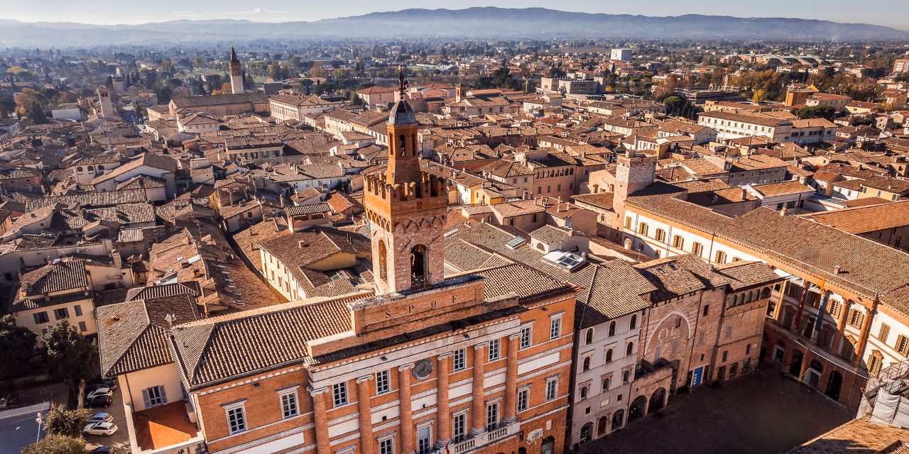
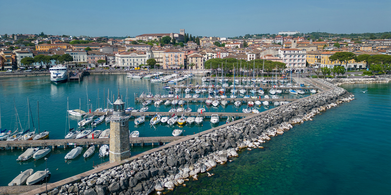
Host city:
Spoleto
Food
- Strangozzi (a.k.a. Strengozze or Stringozzi): a local type of pasta of very humble and ancient origins. Strangozzi owe their name to their shape, similar to the leather laces of a shoe, and are slightly thicker noodles than the traditional ones, with a flour-based dough and no eggs. Strangozzi are paired with simple, essential condiments: Spoleto oil first and foremost, but also fresh tomatoes and forest products such as wild asparagus, mushrooms and truffles.
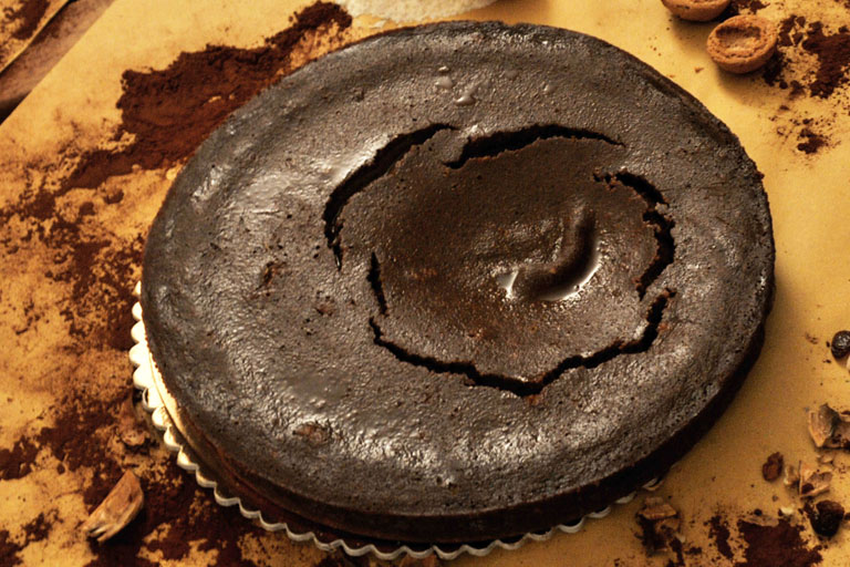
- Crescionda: among the many traditional sweets, Crescionda is undoubtedly the most typical cake of the Spoleto area, despite being rather unknown in the rest of the region. When cut, it is made up of three layers: the first, consisting of macaroons and flour, the second, a light central layer like vanilla pudding, made up of milk and eggs, and the third, dark-coloured layer consisting almost exclusively of chocolate.
- Attorta: once prepared for the main festivities throughout the year, today this cake is maily a Christmas or winter dish. The Attorta, known in other parts of Umbria as ‘rocciata’, is reminiscent of the more Nordic ‘strudel’ and is composed of a coil of pastry twisted on itself, filled with apples and other ingredients including sultanas, pine nuts, walnuts, chocolate and alchermes.
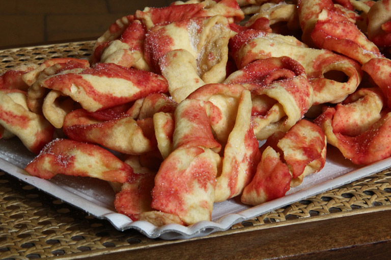
- Castagnole: the dough for Castagnole is made of eggs, sugar, flour and lard, to which honey and mistrà are then added. They are also called sfrappe or fennel. Castagnole get their name from their small, rounded shape, similar to that of chestnuts, and are fried in hot oil and then sprinkled with alchermes. They match perfectly with vin santo.


Points of Interest
- Track of the former Spoleto-Norcia railway: the 51-km railway line from Spoleto to Norcia was inaugurated in 1926 and remained operational until 1968. The line had all the characteristics of a narrow mountain railway and was considered a masterpiece of engineering and environmental integration. The route, surrounded by enchanting natural scenery, has over the years been almost entirely redeveloped and turned into a greenway that can be enjoyed on foot or by bicycle. The route, which allows you to discover the Umbrian Valley through enchanting and little-known locations, has been awarded as the best greenway in Italy.
- Rocca Albornoz: Spoleto’s Rocca Albornoziana stands on top of Colle Sant’Elia, at the highest point of the town. It was built around 1360 as part of the system of fortresses erected by Cardinal Albornoz to defend the territories of the Papal State, in view of the definitive return of the papal seat from Avignon to Rome. It is rectangular in shape, with two large inner courtyards and six towers. The Rocca is currently a museum site and houses the National Museum of the Duchy of Spoleto. Beneath the Rocca stands the impressive Ponte delle Torri, another Spoleto landmark, once an aqueduct. The bridge’s 230-metre-long pedestrian walkway enables visitors to quickly reach Monteluco, a mountain dear to St Francis and the people of Spoleto. It is criss-crossed by trekking paths offering superb views of the city and the Spoleto Valley.
- Piazza Duomo: a splendid view opens up from the top of the steps in Via dell’Arringo over the scenic Piazza Duomo, created in the late Middle Ages by excavating a terrace at the foot of the Sant’Elia hill. To the left of the square is the Teatro Caio Melisso, built in the second half of the 17th century, and the church of S. Maria della Manna d’Oro, dating back to the 16th and 17th centuries. Across the square stands the Cathedral of Santa Maria Assunta, the spiritual centre of the city, dating back to the 12th century. Piazza Duomo is the venue for the final concert of the famous Festival dei Due Mondi, held regularly since 1958 and attracting artists and fans of music, theatre, dance and visual arts. This year, the Festival dei Due Mondi will be held from 28 June to 14 July; the programme for the next edition is available on the official website of the Festival: festivaldispoleto.com
- Palazzo Collicola: Palazzo Collicola is an imposing aristocratic palace built between 1717 and 1730 at the behest of Cardinal Francesco Collicola. Originally, it counted one hundred and ten rooms arranged on four levels, in addition to the rooms in the basement and attics, and overlooked what used to be the family stables, now Piazza Collicola. Palazzo Collicola is currently the seat of the Art Gallery. The Palazzo also houses the Giovanni Carandente Library, a remarkable collection of contemporary art with over thirty thousand volumes that are catalogued and available for consultation. More information available at on the website of Palazzo Collicola.
- Teatro Nuovo “Gian Carlo Menotti”: the New Theatre was built between 1854 and 1864 to a design by the Marchigian engineer Ireneo Aleandri. The theatre is easily accessible via the underground walkway connecting the Posterna car park to the upper part of the historic centre. The town of Spoleto has in fact equipped itself with a modern system of car parks, escalators and moving walkways that allow visitors to leave their vehicles just outside the centre and then move around comfortably on foot.
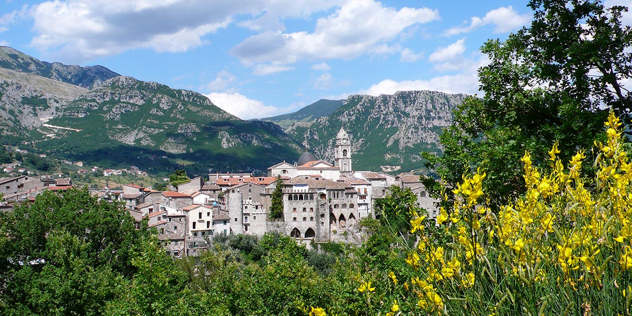
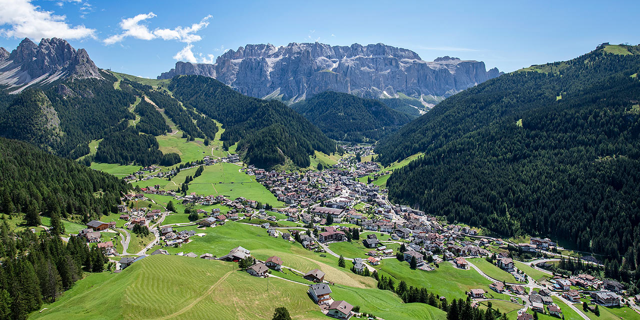
Prati di Tivo
Points of Interest
Pietracamela is an ancient village located near the course of the Rio Arno at an altitude of 1,005 metres. The centre, perched on a mountain slope and surmounted by a looming rock, consists of elevated buildings and narrow cobblestone alleys surmounted by small balconies that look out onto belvedere terraces and dominate the Gran Sasso mountain range on one side and the vast panorama of the province of Teramo in the valley on the other.
Entering the small streets of the village among the stone houses, one comes across the ancient church of San Giovanni Battista, built in 1432, containing a wonderful and impressive weight clock mechanism from 1700. Continuing along the narrow streets we reach the Church of San Rocco, built in 1530 and dedicated to the saint during the plague that was raging throughout the peninsula at that time. Close by is also the imposing Church of San Leucio, Pietracamela’s patron saint.
Pietracamela’s peculiarities are undoubtedly the rock paintings by master Guido Montauti (1918-1979), an internationally renowned artist who was a native of this town. This is an open-air museum and a destination for visitors all year round.
Pietracamela is well-known within the Italian mountaineering world, as it gave birth and is still home to Italy’s longest-living mountaineering association, the ‘Aquilotti del Gran Sasso – Alpinisti di Pietracamela’, which will celebrate its 100th anniversary in 2023.
A short distance from Pietracamela is the village of Intermesoli, which also boasts ancient origins and, between the Middle Ages and the Renaissance, was a highly populated centre thanks to wool processing and forestry activities.
top sponsor


sponsor


official partners


official suppliers


official licensees